|
Lower Neely Grove CemeteryBenton Township, Section 26Andrew County, Missouri
Directions: From Rosendale, east on State Route 48, 1.5 miles to County Road 127. Go west, north and west 0.5 mile to CR 128. The cemetery is on the east side of 128.
Credits: These pictures were taken by Bob Long; Joe and Keith Stanton, 2005; Nadine Taylor and Betty Halvorsen, 2006. (c)THE Transcriptions (Taylor, Halvorsen, Eshelman).
. . . [Yes! There’s more!]
Long Branch Christian Church CemeteryRochester Township Section 29Andrew County, Missouri
Directions: From Savannah, take US Business 71 east on State Route E 3.5 miles to SR D, then south on SR D for 3 miles to CR 312, east on CR 312 (which becomes 311), to Long Branch Church and cemetery.
Notes: Reportedly, African-American burials from St. Joseph were made “near the fence” of Long Branch Cemetery. There are no markers of these burials.
Credits: These pictures were taken by Joe and Keith Stanton, 2005, and Betty Halvorsen, 2006. (c) THE Transcriptions (Taylor, Halvorsen, Eshelman).
. . . [Yes! There’s more!]
Lehman GraveJefferson Township, Section 35 NorthAndrew County, Missouri
Directions: About 1.5 miles north of I-29 overpass on 71 Highway to Road 345. East on 345 1 mile to private land. Stones located behind cattle shed. Owner said that the stone had been bulldozed down from the hill to the north many years ago. On private property, behind a fence, so permission must be gained.
Notes: The name “Martha” is on the back of the John Lehman footstone. It may have just been a stone previously carved by the monument company, or it may indicate another burial.
Credits: These pictures were taken by Betty Halvorsen, 2005. (c)THE Transcriptions (Taylor, Halvorsen, Eshelman).
. . . [Yes! There’s more!]
Leemaster Grave Nodaway Township, Section 22 South Andrew County, Missouri
This cemetery is no longer extant.
LaVerna Heights CemeterySavannah, Nodaway Township, Section 16Andrew County, Missouri
Directions: From Highway 71, at south edge of Savannah, go west on Park Avenue approximately 2 blocks, on LaVerna Heights property. West of buildings, south of road approximately 100 feet. Fenced, walk through, beautifully kept.
Credits: These pictures were taken by Betty Halvorsen, 2005-12. ©THE Transcriptions (Taylor, Halvorsen, Eshelman).
. . . [Yes! There’s more!]
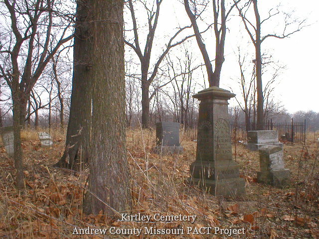
Kirtley CemeteryEmpire Township, Section 26 WestAndrew County, Missouri
Directions: From Savannah, east on Hwy. E 3.5 miles to D. North about 5 miles on D to CR 195. East on 195 for 2 miles. At a curve, 195 becomes 221 and goes north and east. Travel 1.8 miles. Turn north on a small rutted gravel/grass/dirt road 0.4 miles to cemetery.
Credits: These pictures were taken by Betty Halvorsen, 2005. (c)THE Transcriptions (Taylor, Halvorsen, Eshelman).
. . . [Yes! There’s more!]
Kimberlin Cemetery Jefferson Township, Section 15 Andrew County, Missouri
This cemetery is no longer extant.
Kellogg Cemetery AKA Turner Cemetery Nodaway Township, Section 20 NorthAndrew County, Missouri
Directions: From Savannah north on US Business 71, about 0.5 mile to CR 156, then north on 156 about 2.5 miles. The cemetery is on the east side of the road, in the corner of a field, but difficult to see from the south, as it is overgrown with small trees and high grass. The one large tombstone can be more easily seen when approaching from the north.
Credits: These pictures were taken by Marlyn Eshelman, 2005, and Betty Halvorsen, 2006. (c)THE Transcriptions (Taylor, Halvorsen, Eshelman).
. . . [Yes! There’s more!]
Jackson CemeteryJackson Township, Section 33Andrew County, Missouri
Directions: From Savannah take US Business 71 and US 59 northwest 5 miles to CR 70, turn north on CR 70, 0.5 mile to CR 71, then west 0.5 mile on CR 71. The tiny cemetery is visible on the north side of the road and can be easily reached up a few block steps.
Credits: These pictures were taken by Marlyn Eshelman, 2005. (c)THE Transcriptions (Taylor, Halvorsen, Eshelman).
. . . [Yes! There’s more!]
Huston TombstoneRochester Township, Section 20Andrew County, Missouri
Directions: From Savannah, 3.5 miles east on State Route E to SR D. South on D to the intersection of D and E. East on SR E 1 mile to County Road 316. South on CR 316 1.5 miles to private home.
Notes: This stone was moved by the landowner from its original location. Pictures below include the area where the stone was originally located, but exact placement could not be found, nor any other markers.
Credits: These pictures were taken by Betty Halvorsen, 2006. (c)THE Transcriptions (Taylor, Halvorsen, Eshelman).
. . . [Yes! There’s more!]
Hobson Cemetery AKA Colburn FarmNodaway Township, Section 25 SouthAndrew County, Missouri
Directions: From Savannah US Business 71, east on State Route E 3.5 miles to SR D, then north and east 0.8 mile to County Road 185, then north 2.6 miles on CR 185 to CR188, then west on CR188 for 1.6 miles to the Y at the end of CR188 which becomes CR186 going south and CR187 going north. These roads are now abandoned. To the north on CR 187 is a locked gate which can only be opened by the land owner. One can drive about 0.4 miles south on the abandoned road CR186 to a gate on the west side of the road. If the gate is open, one can drive approximately 0.25 mile and cross the pond dam, but at that point the road ends. From there, walk about 0.25 mile west to the . . . [Yes! There’s more!]
High Prairie Baptist CemeteryMonroe Township, Section 5 WestAndrew County, Missouri
Directions: From Avenue City, US Highway 169 northeast 1.2 miles to County Road 291, then east 0.5 mile. The cemetery can be seen off the south side of the road.
Notes: The church connected with this cemetery has been gone many years.
Credits: These pictures were taken by Joe and Keith Stanton, and Betty Halvorsen and Nadine Taylor, 2005 and 2012. (c)THE Transcriptions (Taylor, Halvorsen, Eshelman).
. . . [Yes! There’s more!]
Helena CemeteryAKA Srite Cemetery and Ueltschi CemeteryHelena, Rochester Township, Section 24 EastAndrew County, Missouri
Directions: From Helena, north on County Road 246 about 1 mile to CR 257, west 0.2 mile. The cemetery sits on the south side of the road at the crest of a hill.
Credits: These pictures were taken by Joe and Keith Stanton and Betty Halvorsen, 2005, and Lisa Sipes. (c)THE Transcriptions (Taylor, Halvorsen, Eshelman).
. . . [Yes! There’s more!]
Hall Cemetery Possibly AKA Stanton CemeteryJackson Township, Section 33Andrew County, Missouri
Directions: From Savannah, north and west on Highway 59 5.5 miles to CR 70. North 0.5 miles on CR 70 to CR 71. West 0.5 miles on CR 71. Jackson cemetery is on the north side of the road. On the south side is a cattle pasture with blue gates across the entrance. Cemetery is about quarter mile walk to the south, at the west edge of a grove of trees.
Credits: These pictures were taken by Betty Halvorsen, 2006. (c)THE Transcriptions (Taylor, Halvorsen, Eshelman).
. . . [Yes! There’s more!]
Hailey Cemetery AKA Latter Day Saints CemeteryMonroe Township, Section 5 WestAndrew County, Missouri
Directions: From Avenue City northeasterly on US 169 0.8 mile.
Notes: All of the Hailey stones face west, and the Eppard stones face east.
Credits: These pictures were taken by Betty Halvorsen, 2005. (c)THE Transcriptions (Taylor, Halvorsen, Eshelman).
. . . [Yes! There’s more!]
Hagler Burial Ground Possibly AKA Wright CemeteryBenton Township, Section 12 SouthAndrew County, Missouri
Directions: From Savannah, 3.5 miles east on State Hwy. E . North on D 10.1 miles to Highway 48, west on 48 1.4 miles to Rea at Post Office on Highway 48. Go South by the west side of PO about 0.1 mile to Wileman St. West on Wileman about 3.2 miles to County Road 175. Go south on CR 175 about 2.3 miles to CR 177. West on CR 177 0.6 mile to CR 179. South on CR 179 for 0.8 mile to gate into pasture on north side of road. Cemetery is at the northwest corner of the pasture by the big tree inside the 4-wire fence.
Notes: Stones are under the fence line for protection from cattle and can be retrieved without going under the fence.
This burial ground was . . . [Yes! There’s more!]
Greenwick CemeteryLincoln Township, Section 31 WestAndrew County, Missouri
Directions: From Amazonia, take Highway K south to, then east at intersection with T, make a left turn (east) on Broadway 1.3 miles to the cemetery, which is up a slope on the left.
Notes: This cemetery was cleared and cleaned in 2001 by Roger Bullock as an Eagle Scout project.
Credits: This cemetery was researched and photographed by Marlyn and Monica Eshelman 2005 and Nadine Taylor and Betty Halvorsen 2005-2008. (c)THE Transcriptions (Taylor, Halvorsen, Eshelman). In 2021, Kurt Jordan had a new sign erected on the site to replace the old, worn one.
Kurt Jordan and Monica Schirmer Eshelman are working on the history of this cemetery and its restoration. You can follow their progress at the Greenwick Cemetery website.
. . . [Yes! There’s more!]
Green Valley Cemetery AKA Wilson CemeteryJefferson Township, Section 20 South Andrew County, Missouri
Directions: From Savannah, south on State Route DD to County Road 375, west .75 mile to CR 379, south 1 mile to CR 384 (which is County Line Road), then 0.1 mile east. Located in the yard of a private home. Permission recommended.
Credits: These pictures were taken by John Bennett and Betty Halvorsen, 2005, and Christopher Cox. (c)THE Transcriptions (Taylor, Halvorsen, Eshelman).
. . . [Yes! There’s more!]
Green GraveJefferson Township, Section 20Andrew County, Missouri
Directions: Directions: South from Savannah city limits on 71 Highway approximately 6 miles to Highway 59. 2.1 miles on Highway 59 to K Highway. North on K 0.7 miles to County Line Road. West on County Line Road 0.5 mile to Old Amazonia Road (CR 386). North on CR 386 0.3 mile. Tombstone is visible from road, on the east. In 2006, there was some new construction and development in this area.
Notes: Samuel Ball Green was a second cousin to President George Washington.
Credits: These pictures were taken by Betty Halvorsen, 2005. (c)THE Transcriptions (Taylor, Halvorsen, Eshelman).
. . . [Yes! There’s more!]
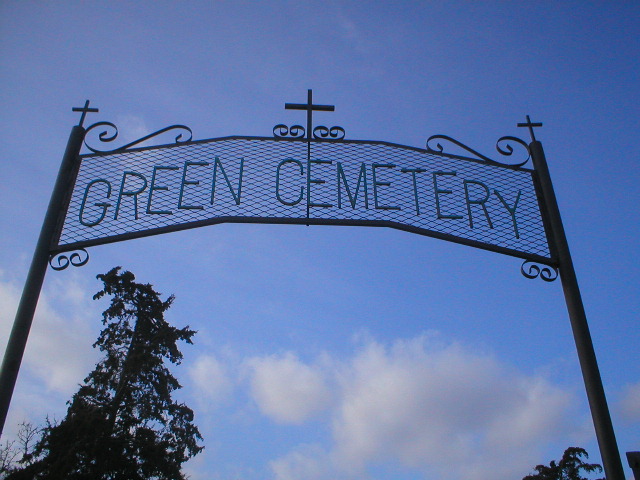
Green CemeteryJefferson Township, Section 19 SouthAndrew County, Missouri
Directions: This cemetery is located at the intersection of I-229 and Highway K. It is on the west side of Highway K. It is at the southwest edge of Andrew County and about 2 miles northwest of the St. Joseph city limits.
Credits: These pictures were documented and photographed by Sharlene Miller, 2005, and Betty Halvorsen and Nadine Taylor, 2007. (c)THE Transcriptions (Taylor, Halvorsen, Eshelman).
. . . [Yes! There’s more!]
Gravel Wall CemeteryClay Township, Section 26Andrew County, Missouri
Directions: From Fillmore, north on State Route H and A intersection, 2 miles to County Road 44, east 2.5 miles on CR 44 to CR 54 0.8 mile to CR 53, west on CR 53, 0.5 mile.
Credits: These pictures were taken by Joe and Keith Stanton, 2005, and Betty Halvorsen, 2006. (c)THE Transcriptions (Taylor, Halvorsen, Eshelman).
. . . [Yes! There’s more!]
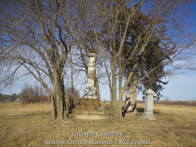
Gillispie CemeteryJackson Township, Section 35Andrew County, Missouri
Directions: From east Savannah city limits, northwesterly on US Business 71 and State Hwy. 59, 3/8 miles to County Road 61, then 1 mile north. The cemetery is in a pasture about 100 yards from the road, and is accessible by walking and permission from the landowner.
Notes: This cemetery was cleaned as part of the Eagle Scout project of Nathan Stone, 2005.
Credits: These pictures were taken by Nathan Stone’s Project, 2005, and Betty Halvorsen, 2006. (c)THE Transcriptions (Taylor, Halvorsen, Eshelman).
. . . [Yes! There’s more!]
Fuller CemeteryLincoln Township, Section 24Andrew County, Missouri
Directions: From Savannah City Limits west on US 71/59, go 4 miles to State Highway CC, then south on CC about 3.5 miles to Count Road 416 (just before crossing over large bridge). East on CR 416 About 0.3 miles. Cemetery is on south side of road and can easily be seen from road.
Notes: In 2008, Tyson J. Keller and members of the Carneal family removed the wild grapevine as a Boy Scout program for Tyson, and he is keeping the cemetery mowed.
Credits: This cemetery was photographed and researched by Betty Halvorsen & Nadine Taylor, 2005 and 2008. (c)THE Transcriptions (Taylor, Halvorsen, Eshelman).
. . . [Yes! There’s more!]
Foultz CemeteryJackson Township, Section 26Andrew County, Missouri
Directions: From Fillmore, east 1.5 mile on State Route A to County Road 58, south 1 mile on CR 58. The cemetery sits in a grove of trees between farmed fields, so permission from landowner should be gained, and access is limited to certain times of year.
Notes: Boy Scouts and volunteers from the project of Dakota Roach cleared and cleaned this cemetery in first winter 2006. It was cleared and cleaned again in late 2006 by Betty Halvorsen and Nadine Taylor. This graveyard is not fenced and cattle graze there, so it is likely that it will soon again return to a natural state. These pictures are therefore priceless.
Credits: This cemetery was documented and photographed by Gregg Clizer, 2005; Betty Halvorsen & Nadine Taylor, 2005-06, and for the Eagle Scout project of Dakota Roach, 2006. (c)THE Transcriptions . . . [Yes! There’s more!]
Flag Springs Cumberland Presbyterian CemeteryEmpire Township, Section 14Andrew County, Missouri
Directions: From Savannah, go east on Hwy E 3.5 miles to D. North on D 3.5 miles to County Road 223. East on CR 223 for 2.1 miles to CR 221. North and east on 221 for 1.3 miles to CR 216. Follow 216 for 3/1 miles to CR 214. North on 214 for 0.1 mile.
Notes: First known as Platte River Congregation.
Credits: These pictures were taken by Betty Halvorsen 2006. (c)THE Transcriptions (Taylor, Halvorsen, Eshelman).
. . . [Yes! There’s more!]
|
|