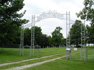
Oak Ridge Cemetery
AKA Black Oak Cemetery or Schneider Cemetery
Monroe Township, Section 17 West
Andrew County, Missouri
Section 1 |
Sections 2 and 3 |
Rows
 Directions: From Avenue City, south 1.2 mile on State Route O to SR W, 1.2
miles south on SR W. There is a drive that runs from the road, through the gate,
between Sections 2 and 3, about halfway through the cemetery until it reaches Section
1, and then goes all the way around Section 1.
Directions: From Avenue City, south 1.2 mile on State Route O to SR W, 1.2
miles south on SR W. There is a drive that runs from the road, through the gate,
between Sections 2 and 3, about halfway through the cemetery until it reaches Section
1, and then goes all the way around Section 1.
This cemetery was photographed and documented by Joe & Keith Stanton, 2005, and Betty
Halvorsen & Nadine Taylor, 2005-7. ©THE Transcriptions (Taylor, Halvorsen,
Eshelman).
* Indicates African-Americans
+ Indicates obituary available
Section 1
Row
Beginning in NE Corner |
Direction of Row |
Photograph(s) |
|
1 (beginning in northeast corner)
|
north to south
|
001-031
|
|
2
|
south to north
|
032-056
|
|
3
|
north to south
|
057-077
|
|
4
|
south to north
|
078-111B
|
|
5
|
north to south
|
112B-135B
|
|
6
|
south to north
|
136-168
|
|
7
|
north to south
|
169-192B
|
|
8
|
south to north
|
193B-207
|
|
9
|
north to south
|
208-260
|
|
North cluster
|
|
261-276
|
|
South cluster
|
|
277-294
|
Section 2
Row
Beginning in NW Corner |
Direction of Row |
Photograph(s) |
|
1 (beginning in northwest corner)
|
north to south
|
001-006 038, 039
|
|
2
|
south to north
|
007-010
|
|
3
|
north to south
|
011-019
|
|
4
|
south to north
|
020-025
|
|
5
|
north to south
|
026, 207B, 036B, 037B, 028
|
|
6
|
south to north
|
029, 030
|
|
Next to road
|
|
031, 032, 033B
|
|
Southeast corner by fence
|
|
034B, 035
|
Section 3
Row
Beginning in NW Corner |
Direction of Row |
Photograph(s) |
|
1 (beginning in northwest corner)
|
north to south
|
001--12
|
|
2
|
south to north
|
013-021B
|
|
3
|
north to south
|
022-027
|
|
4
|
south to north
|
028B-035
|
|
5
|
north to south
|
036-042Bb
|
|
6
|
south to north
|
043-044B
|
|
7
|
north to south
|
045B-047
|
[Return to Top]