Hobson Cemetery
AKA Colburn Farm
Nodaway Township, Section 25 South
Andrew County, Missouri
 Directions: From Savannah US Business 71, east on State Route E 3.5 miles
to SR D, then north and east 0.8 mile to County Road 185, then north 2.6 miles on
CR 185 to CR188, then west on CR188 for 1.6 miles to the Y at the end of CR188 which
becomes CR186 going south and CR187 going north. These roads are now abandoned.
To the north on CR 187 is a locked gate which can only be opened by the land owner.
One can drive about 0.4 miles south on the abandoned road CR186 to a gate on the
west side of the road. If the gate is open, one can drive approximately 0.25 mile
and cross the pond dam, but at that point the road ends. From there, walk about
0.25 mile west to the top of a steep hill and then a bit north to the cemetery.
Directions: From Savannah US Business 71, east on State Route E 3.5 miles
to SR D, then north and east 0.8 mile to County Road 185, then north 2.6 miles on
CR 185 to CR188, then west on CR188 for 1.6 miles to the Y at the end of CR188 which
becomes CR186 going south and CR187 going north. These roads are now abandoned.
To the north on CR 187 is a locked gate which can only be opened by the land owner.
One can drive about 0.4 miles south on the abandoned road CR186 to a gate on the
west side of the road. If the gate is open, one can drive approximately 0.25 mile
and cross the pond dam, but at that point the road ends. From there, walk about
0.25 mile west to the top of a steep hill and then a bit north to the cemetery.
Note: Permission must be gained to go through private property.
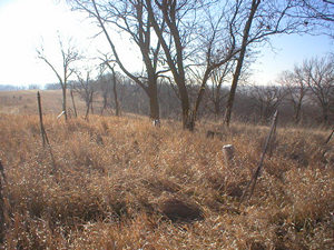
These pictures were taken by Betty Halvorsen, 2006. ©THE Transcriptions (Taylor,
Halvorsen, Eshelman).
Row
Beginning at NW Corner |
Direction of Row |
Photograph(s) |
|
1
|
North to south
|
07-15
|
|
2
|
South to north
|
16-47
|
[Return to Top]