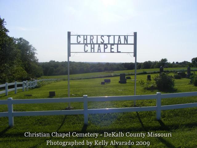
Christian Chapel Cemetery
Adams Township
Township 58, Range 30, Section 11
Weatherby, DeKalb County, Missouri
Christian Chapel Cemetery is approximately four miles south of Weatherby in DeKalb County, Missouri. The church itself is no longer standing, but there is a memorial stone at the site. The cemetery has a nice white vinyl fence around it, with a small driveway and parking area, and a gate on the south side.
From Cameron, at the intersection of Hwy 36 and Hwy 69, drive north on Hwy 69 about one mile (passing the state prison on the right). At the fork in the road, bear left onto County Hwy EE and follow it for approximately 5 miles. (The road, as country roads often do, will take a 90 degree turn to the east, and then 90 degree turn back to the north, go for about a mile, and then take another 90 degree turn to the east.) At that second turn to the east, you will want to go straight onto SE Willow Road, which is a gravel road. Immediately after you are on the gravel road, on the west/left side, you will see the church memorial stone, then a small copse of trees, and then the cemetery.
On 28 May 1877, the land was deeded from William West and his wife, Nancy to Jacob Taylor, William Wood, John Bradford, Trustees. The board members were Cecil Wright, Oscar Bradford, Clarence Bradford, John Drice, and the caretaker was H. O. Whitaker.
Credits: Kelly Alvarado submitted the photographs for this cemetery.
| Updates, corrections and additions: |
|
Continue reading →