 Directions: From Rosendale, east on State Route 48, 1.5 miles to County
Road 127. Go west, north and west 0.5 mile to CR 128. The cemetery is on the east
side of 128.
Directions: From Rosendale, east on State Route 48, 1.5 miles to County
Road 127. Go west, north and west 0.5 mile to CR 128. The cemetery is on the east
side of 128.
Directions: From Rosendale, east on State Route 48, 1.5 miles to County
Road 127. Go west, north and west 0.5 mile to CR 128. The cemetery is on the east
side of 128.
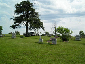
These pictures were taken by Bob Long; Joe & Keith Stanton, 2005; Nadine Taylor and Betty Halvorsen, 2006. ©THE Transcriptions (Taylor, Halvorsen, Eshelman).
| Row
Beginning in NE Corner |
Direction of Row | Photograph(s) |
|---|---|---|
| 1 | North to south | 001, 002, 353, 003-044 |
| 2 | South to north |
045S-048, 354, 049-066, 355,
067S, 105S, 356, 068-074, 058L, 075-077, 357, 078a-081, 358, 082-087S |
| 3 | North to south | 088-107, 359, 108-131 |
| 4 | South to north |
132S-136b, 141, 137B-140,
142S-152, 350N, 153S-158b, 360, 159a-165c, 361, 166a-168, 362, 169-172c |
| 5 | North to south |
173-175, 352, 177S-189S, 331a,
331b, 190S |
| 6 (two trees in this row) | South to north |
191-197b, 201, 199, 363, 202,
198S, 200S, 203-208, 330, 332, 209S-217c, 351, 218a-220b |
| 7 | North to south |
221a-238, 241, 239S, 240S, 242S,
243-246S |
| 8 | south to north |
247S-260, 264, 265a, 265b,
261-263S, 266a-274 |
| 8.5 | 275, 364, 276a, 276b | |
| 9 | North to south |
277-281c, 365, 282a, 282b, 334,
283-293, 333, 294-305S |
| 10 (very irregular) | 306S-308d, 335, 310-329 |